You are here
8
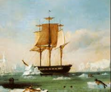
In 1838, Captain Charles Wilkes led the first US expedition to Antarctica. The flora, fauna, maps and other findings from the Exploring Expedition (or Ex Ex, as it was known in the family) made up the first exhibit at the Smithsonian Institute – the building designed by his nephew, James Renwick, Jr. (Oil painting of ship. U.S.S. Vincennes attributed to Captain Charles Wilkes.)
Most Naval Historians agree that Captain Wilkes' most significant finding, however, is documented proof that Antarctica is a separate continent. Many travelers had reached this part of the globe, but the Captain Wilkes finally resolved the issue. From that time on, maps of the Earth were redrawn to include the seventh continent. A large portion of the east of Antarctica was named ‘Wilkes Land.’ -- Mary Anne Junqueira. “The Objectives of the U.S. Exploring Expedition's Circumnavigation (1838-1842): Longitude, Nautical Charting and the Establishment of Modern Geographic Coordinates.” História, Ciências, Saúde - Manguinhos, vol.19, no.1 (January-March 2012)
